| Written Directions |
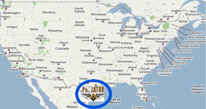
Map: USA Overview |
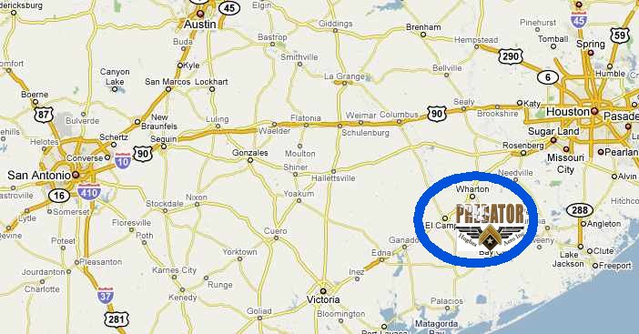
Map: Southeast Texas |
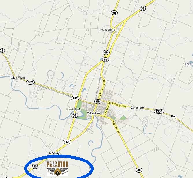
Map: Wharton Area |
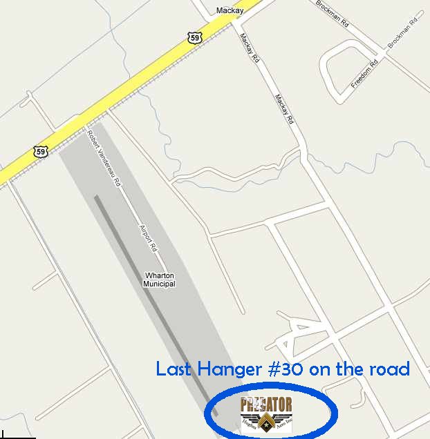
Map: Wharton Airport |
Written Directions |
![]()
<click HERE for the printable Adobe PDF version of our Directions>
____________________________________________________________
____________________________________________________________
Southeast Texas (regional map)
____________________________________________________________
____________________________________________________________
____________________________________________________________
<click HERE for the printable Adobe PDF version of our Directions>
SkyTrails LSA – Home of the Predator PPC
Phone: 979-282-2005
Wharton, Texas
N 29º 15’.25666 / W 96º 9’.26333
100-ft MSL
___________________________________________________________
From Houston: When coming from Houston,
Wharton Airport is about a 40-minute drive, south on Hwy 59, from Sugar Land. Wharton city has three exits, go past all three exits. You will then soon see (less than 1-mile) the Gas Station & “JR’s Smokehouse” on the right and “Carroll’s Gun shop” on the left, just past these businesses are two highway
crossover’s (on the left side of the road) one right after the other. The second left turn area is for the Wharton Regional Airport. Turn left and cross the highway just pass the “Wharton Airport” sign (on the left) the street
sign will say Robert Vonderau Road.
This road turns left just past the oil well and then immediately turns right. If you then just follow this southbound road all the way to the end of the road (about ¼ mile, to the last grouping of Hangars (Hangars #29, 30, 31 & 32). This is the place where SkyTrails LSA is building, flying, training & servicing Powered Parachutes. Our grass flight field is on the back side (the south side) of the Hangar complex.
WELCOME to our Home!
From Victoria: Going northeast on Hwy 59 from Victoria, Wharton is about 11-miles northeast of El Campo, Texas. The “Mac Kay” sign on the right of the highway will let you will know that you are getting
close to Wharton Airport. You will see the airstrip and Blue hangers on your right. There is a right turn lane on the shoulder to help you get out of the way of highway traffic while you slow down to make the turn.
This airport road turns left just past the oil well and then immediately turns right. If you then just follow this southbound road all the way to the end of the road (about ¼-mile, to the last grouping of Hangars (Hangars #29, 30, 31 &
32). This is the place where SkyTrails LSA is building, flying, training & servicing Powered Parachutes. Our grass flight field is on the back side (the south side) of the Hangar complex.
WELCOME to our Home!